
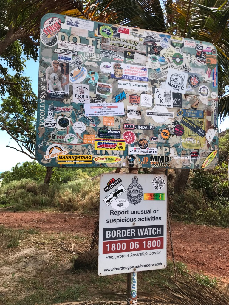
To the Tip, Tourist Mecca of FNQ, this is a one off experience !
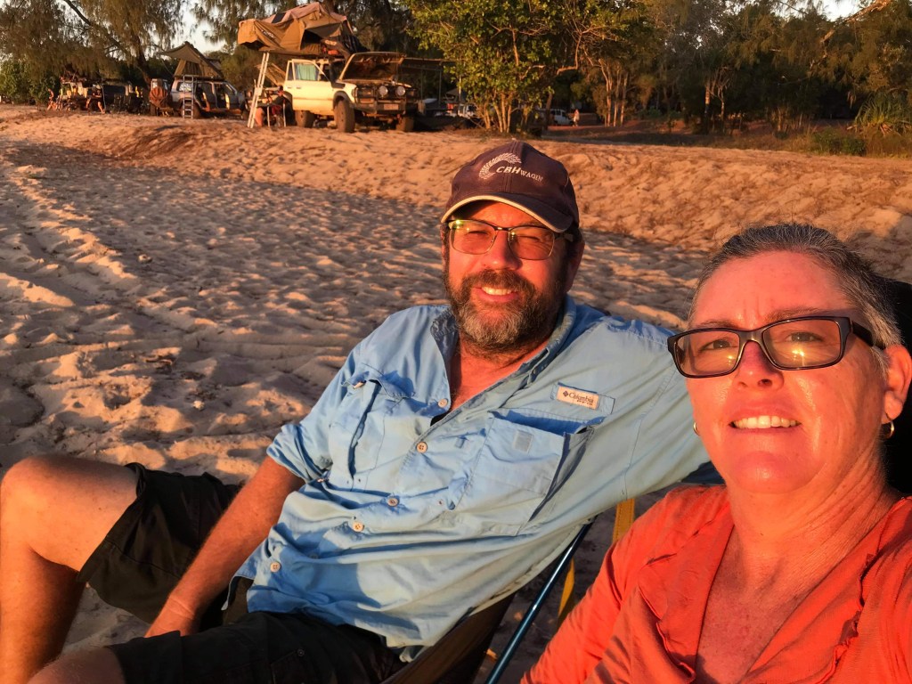
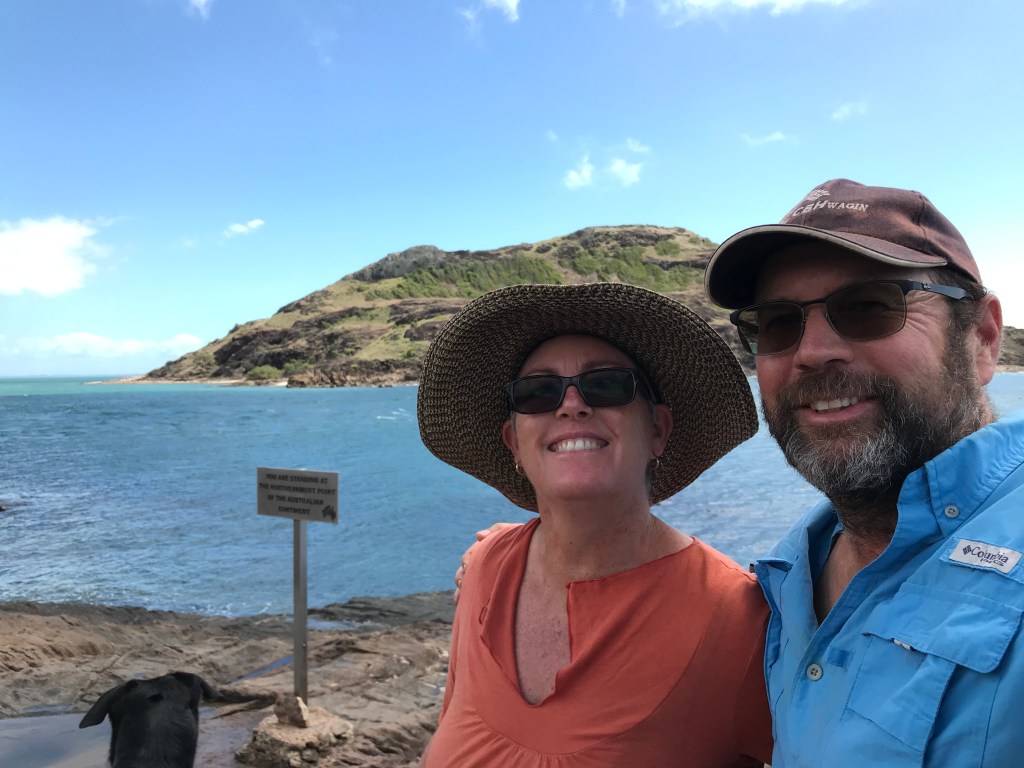
- Feature Photo: Jenny and Will finally reach the northern most point of Australia.
- Week 8, Australia Pandemic Tour Travel Diaries.
- 29/07/21 to 05/08/21
- Day 50 to 56
- McLeod River, free bush camp to Loyalty Beach, Bamaga Qld.
- 810kms (total since home, 8659kms). Lots of rough dirt roads.
We are at a cross roads, Port Douglas has been achieved, we’ve seen Mum, Jens & Bro, Geoff, time to head for home now ?!
No way Jose ! Let’s do the Tip, Cape York, Australia’s most northerly point. With the exception of the OEM supplied, Dunlop Grandtrek Highway Tyres on the 200 Series Landcruiser we are as ready as we will ever be. Intuitively both Jenny and I know this is it. We will never likely get another chance or be here again for a very long time. So it’s an opportunity not to be missed.
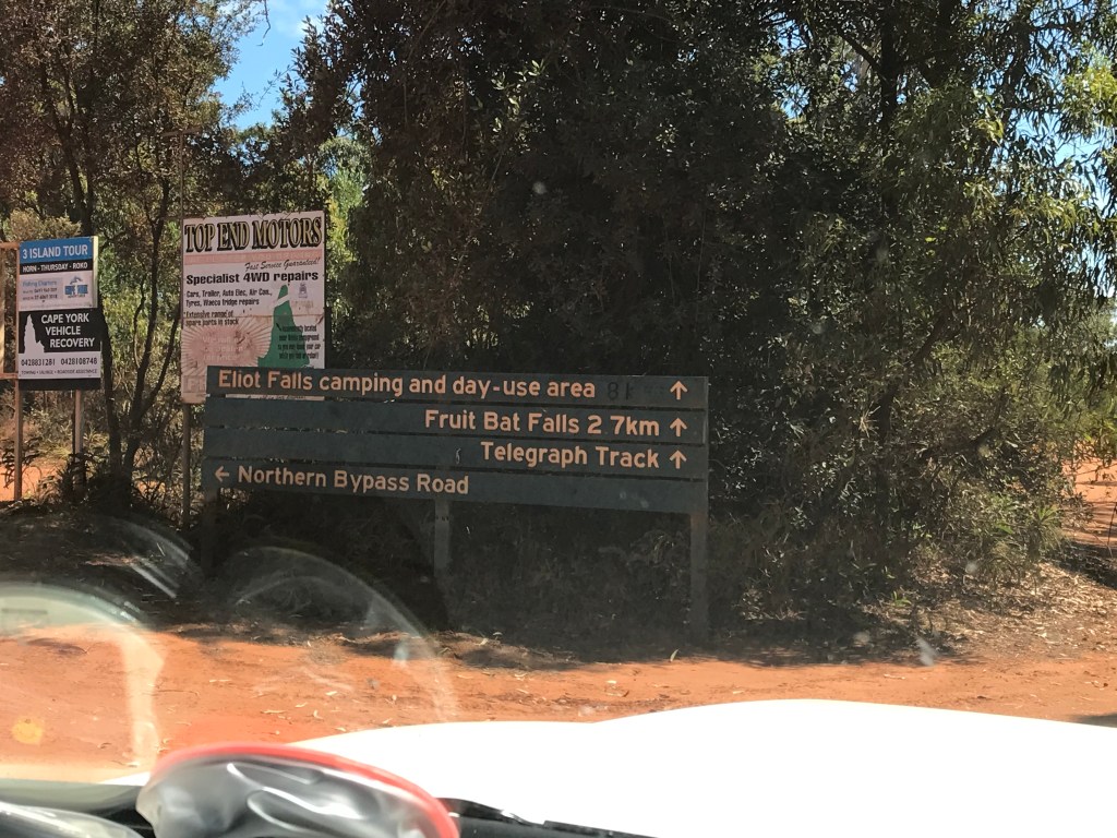
It’s about 900kms one way and if you’re towing with a pet dog on board there isn’t many route options except the Peninsula Development Road that turns into the Telegraph Road about 40kms north of Archer River. The hardcore off-road enthusiasts often opt the the Overland Telegraph Track or OTT for short. We did a bit of it out to Eliot Falls and later found out that we would have probably come stuck at Nolan’s Crossing where the water was extra deep and many vehicles were being “drowned” (I’ll have to check out some videos of Nolan’s on YouTube).
The route we took was straight forward enough, with a mixture of bitumen, good gravel and bad gravel. After Bramwell Roadhouse the road conditions rapidly deteriorate and it’s slow, rough going nearly the entire way to Bamaga. I recall the 10kms leading into Jardine River where you catch the barge was in good nick and had been recently graded. Apart from that the “road” was a shocker ! We had the tyres on the Landcruiser down to 30psi and camper 35psi.
My travel diary notes below will give you an insight as to how our Cape York side trip went. Definitely worth the effort and good to see the biggest down side and obstacle for us getting there is distance and time from home. To a lesser extent having the dog restricted us from accessing the National Parks but she did keep the thieves at bay in Bamaga. I hope you enjoy this weeks saga.
Day 50, Thursday, Date: 29/07/21
From to where: McLeod River free camp to Morehead River
Distance: 266km
Accumulated Distance: 8115km
Cycling Y/N, KMs: no
Fuel $: 78 @ 170.7cpl
Litres: 50L
Accom type & cost: free camp on banks of Morehead River 140km south of Coen.
Grocery Food $:
Take away food $: 23 B&E toasties with coffee at Lakeside BP
Beer/Wine/Soda $:
Other $:
Day Total $: 101
Rolling Total $: 7335 (daily spend average currently at $147 per day).
Gopro footage: yes GP8, including bogged in river bed.
DJI Drone Footage: no
Weather: cool morning with lots of due, fine day 31C.
Notes: The Peninsula Development Road begins.
Not long to the beginning of the gravel now, a steady stream of dirty dusty mud encrusted vehicles often towing a trailer are heading south. We’ve just come out of a long road work section north of Laura and the last of three cars heading south flicks up a rock which hits the top right side of the windscreen. “CRACK” first star for the trip and it’s a decent one. Bummer, at least it lasted 9000kms crack free.
Jenny and I had an early morning, we were up and on our way by 8.20am, there was a breakfast break at Lakeside where we cross paths with the oldies travelling around in the 4WD Blue Coaster Bus. Last time we saw them was back at El Questro in July 2019. We had a quick chat but Steve was busy fuelling up his bus, though he did remember us. Onwards we went, the beginning of the Peninsula Development Road started off through farm land, bananas, nuts, cattle, green vegetables of some sort.

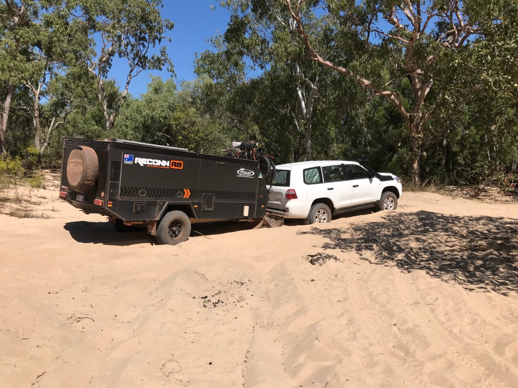
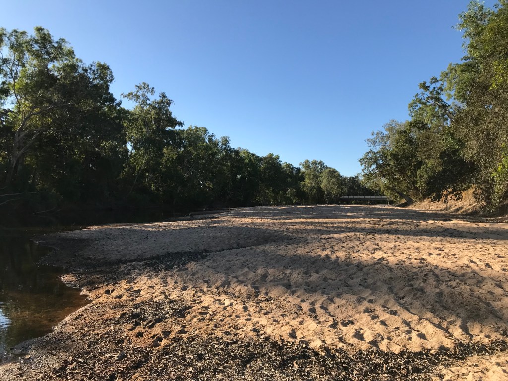
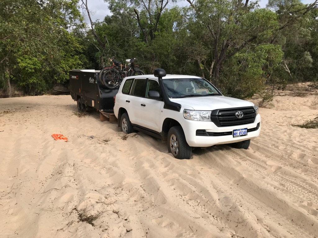
We stopped in Laura at 11.20am to top up on fuel, empty our rubbish and use the toilet. About another 95kms further on, not long after getting the stone chipped windscreen, we fitted our Stone Stomper rock guard. Then we arrived at a possible 24hr camp location by a bridge on the Morehead River. It was to close too the road and very dusty. Jenny got me to backtrack to a small side track she had noticed 300 metres back and we drove in about 700mtrs to the Morehead River. It’s very sandy but I’m confident we can get through to a nice spot under the trees by the river bank.

Four wheel drive, low range but with tyre pressures at full, about halfway across the Landcruiser and trailer bog down in the soft white river sand. Whoops, Jennifer wasn’t happy but to late now. It ended up taking about 30 minutes and three attempts to extract ourselves. Deflate tyres to 20psi, shovel out the mounds of sand in front of the 6 tyres, we even used the two Max Trax for the first time ever and they were a big help.
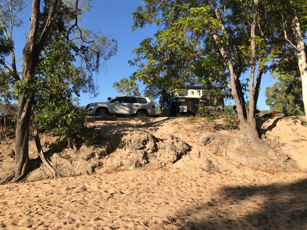
Initially we were not totally certain we’d stay here when we arrived just after 1pm but by the time we had unbogged the vehicle and had lunch it was time to call it a day. There are fresh water crocodiles in the pools still in the river, they are super shy but we have seen 5 all under 1 metre in length.
It’s a nice spot, lots of birds, fish in the water and we’re the only one’s here.
~~~~~~~~
Day 51, Friday, Date: 30/07/21
From to where: Morehead River to “Boulders” Gravel Pit east, 10km north of Archer River Roadhouse.
Distance: 220km
Accumulated Distance: 8335km
Cycling Y/N, KMs: no
Fuel $: 80 @ 185cpl
Litres: 43.25L economy equals 17.5L per 100km.
Accom type & cost: free, Gravel Pit 10km north of Archer River, east side.
Grocery Food $: 55 Coen
Take away food $:
Beer/Wine/Soda $: $90 & 2x beer at Coen Pub and block of XXXX Beer.
Other $:
Day Total $: 225
Rolling Total $: 7560
Gopro footage: GP8
DJI Drone Footage: no
Weather: 26C overcast with sunny patches, SE wind.
Notes: More bogging and damage.
It was a beautiful morning watching the birds and enjoying our coffee on the bank of the Morehead River, but both of us knew we were in for a tough exit out of there. At 9am we were ready to go, low range second and we actually mage it about 30 metres or 60% of the way until the wheels started spinning & bogging down. Lots of cursing, digging, Max Traxs and eventually crawl control helped extract us from the dry sugary sand.

As the tyres were way to low in pressure for normal travel we then had to pump them up before our days driving could begin at 9.50am. The road was a mix of decent gravel and long sections of high quality bitumen. Great care was required in the many floodways and wash outs. After 37kms we stopped at Musgrave Station, originally a Telegraph Station, now a Roadhouse, Pub, Museum, etc. while there Jenny and I got talking to “Cal” a bloke in his late 40’s touring with his wife who were heading home to Malanda after reaching the Top in his turbo diesel 100 series Landcruiser towing a *Mega Van*. We also discovered that Cal is Mike and Liz’s neighbour.
Cal advised us to let out tyres down even more as the road around Archer River is really bad. Musgrave was seriously busy with travellers who were obviously heading south when you looked at the state of their rigs compared to ours. At our next rest stop I did actually lower our tyre pressure after Cal gave me the heeby-jeeby’s to 30psi front, 32psi rear and 35psi on the trailer. As it turned out the road conditions have been fine since Lakeland to this gravel pit but know doubt once we get on the Telegraph Road in 50kms the conditions will deteriorate.
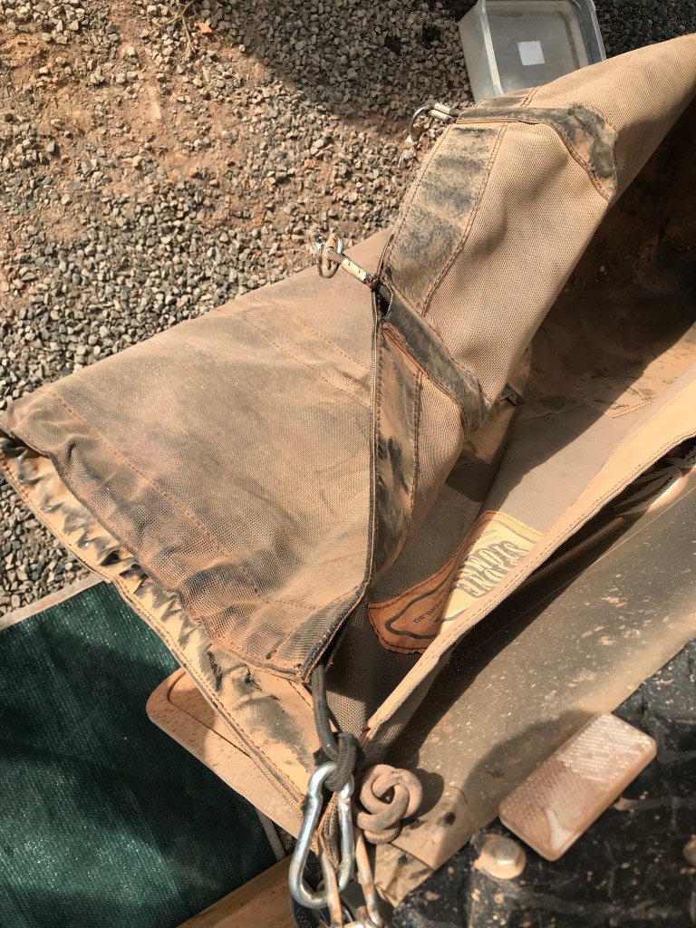
We stopped at Coen for lunch, fuel, some minor food shopping and have a beer at the Pub. Also noticed the 4WD Blue Coaster Bus from WA parked on the main street. While in Coen I bought a block of beer ($90) undid the left side of the Stone Stomper and placed the beer block near the fridge in the car. Something (someone) then distracted me and I forgot to hook it back up. On the way out of town I had that “feeling” and asked Jenny to check the trailer wheel and Stone Stomper, the passenger has a reasonable view in the mirror from that angle especially on slight left turns. Jen reported it all looked fine.
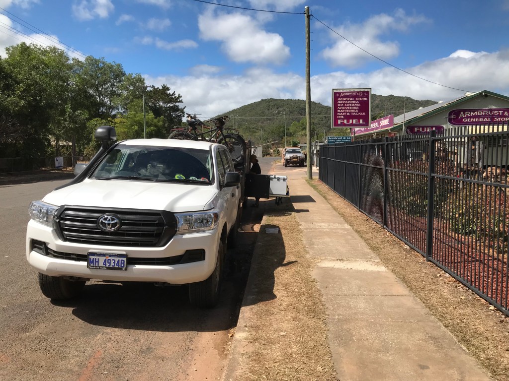
After a 110km we stopped at the Archer River, you can pay to stay at the Roadhouse campground or there is free camping along the river. It was packed and there was no chance we would fit in there. Jenny says uh oh the Stone Stomper isn’t connected on the passages side and is now missing the outside bar connector buckle, the middle connector buckle is damaged from bouncing on the road but still useable, the mesh seems fine. I’m mainly pissed at myself for ignoring my gut feeling and not stopping on the outskirts of Coen. Anyway it’s fixed as best as it can be when you’re on the road and no doubt will last until we get home.
Last night I noticed the brake controller on the trailer had faulted for the third time this trip. I’m thinking it’s related to when you engage 4WD Low as the electronic wizardry of the LC200 uses alternate braking on wheel spin to mimic diff locks. It’s a noisy thing when doing it but seems to work fairly effectively. My current thoughts are that this function confuses the trailers brake controller and the trailer brakes stop working.
We now know how to recalibrate them but the trailer brake controller needs to be powered off which means disconnecting the house battery, not an easy task as all gear has to cube unloaded so you can lift up the access hatch. Then you also need to reset water and battery management meters. Will have to look at getting a battery isolator installed when we eventually upgrade the power system. Any further Low Range 4WD manoeuvres will mean disconnecting the trailer brakes first. Maybe we should have just repowered the old 105 Series, less electronics to think about when off-road.
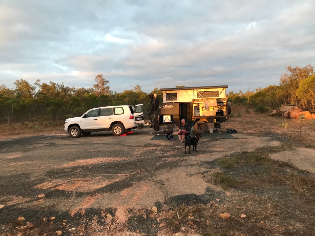
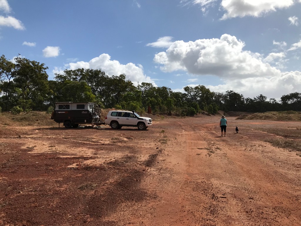
After 220kms and 10kms north of Archer river we noticed a track on the right side of the road just over a hill, quickly we turn in, it’s a disused gravel pit. We drive in to far and have a difficult u-turn to perform so we can back track to the first suitable spot we saw. It’s now 4pm and looking like rain. Later we did get a small smattering of rain but overall a very pleasant night.
*Mega Van, any full height caravan over 24′ (8 metres) long, they usually weigh up to 3.5 tonne. More often then not they’re overloaded.*
~~~~~~~~
Day 52, Saturday, Date: 31/07/21
From to where: Boulder Gravel Pit to White Dam Gravel Pit (25km north Bramwell Roadhouse).
Distance: 183kms
Accumulated Distance: 8518kms
Cycling Y/N, KMs: no
Fuel $:
Litres:
Accom type & cost: Free, White Dam Gravel Pit.
Grocery Food $: 25 bbq pack from Moreton Telegraph Station.
Take away food $: 15, pies and cool drink.
Beer/Wine/Soda $:
Other $:
Day Total $: 40
Rolling Total $: 7600
Gopro footage: GP8, yes
DJI Drone Footage: no
Weather: light rain in early hours of morning, cloudy 29C strong SE wind.
Notes: They Drive like Idiots.
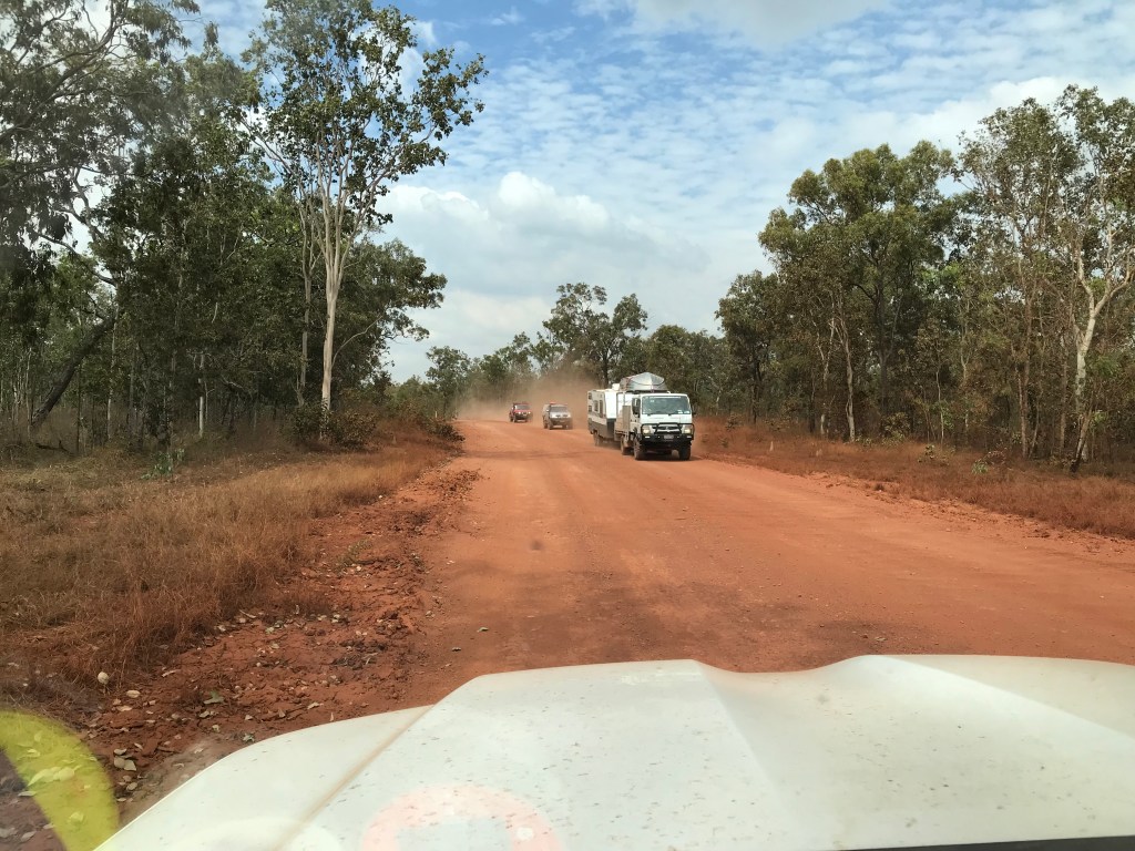
What is the hurry people ? Do you just want to see how quickly you can damage your vehicle and equipment ? Maybe you enjoy recklessly flicking up fist size rocks into the oncoming vehicle that have courteously slowed down for you. Obviously not everyone drives like a jerk just half of them (actually it’s about 30% who are inconsiderate drivers).
This is what Jenny and I are presently experiencing, vehicles often towing all styles of campers/caravans driving well north of 80km/h along seriously corrugated roads. More often than not there will be, one, two or maybe three vehicles right up each other’s dates sucking in copious amounts of dust (dusty AF convoy). Sometimes without headlights on, you can not even see them. We have to pull over across too the far left and slow down to 10km/h keeping ready to take evasive action into the scrub if some knucklehead decides it’s a good time to pass.
None of them use their radios (do they have a radio, are they on channel 40)? It’s a bit nerve wracking. The worst offenders are usually driving Patrol GU’s or Toyota 79 Series V8 Utes and generally have southern states rego plates on them. Don’t worry heaps of nobs are in 200 Series like us or Dodge Ram Pickups like my USA mates towing their mega vans a bit quick for the conditions also. Once upon a time in my distant pass I’d just speed match them as payback but I’m older and wiser now, so slow and keep way left is the smart game plan.
The best practice on the rough gravel is to drive to conditions but if no one is around by all means cut sick. When you see an oncoming vehicle, they’re easy to spot as they should have their headlights on and there is a plume of red dust billowing out from behind them, slowing down to 40km/h – 50km/h as you pass would be reasonable speed.
Pull over as far to the left as you safely can, just because the oncoming car has courteously pulled far left isn’t a message for you to hog the centre of the road. Once you pass each other maintain the slower speed until the dust clears and it safe to accelerate. See not hard is it !
If you’re overtaking someone going the same direction on the gravel road try contacting them on the UHF radio, channel 40. If they don’t respond drop back and on the straight sections ease out of their dust cloud with your headlights on to the right side of the road. You are trying to get their attention before passing. Maybe flash your high beam or even toot your horn. Once they notice you they should ease over to the left and even slow down a bit. They may even indicate that they’re pulling over. If you can see the front is clear that’s the time to pass.
Pass gently and remain right as long as it’s safe to do so, that way you don’t shower the car you have just passed with rocks and dust and they still have good forward visibility. You want to be driving well below your skill level out here because when shit goes wrong it happens fast and if you’re driving to your maximum ability you will not be able to recover and what happens next is pure good or bad luck. I know this from hard earned personal experience !
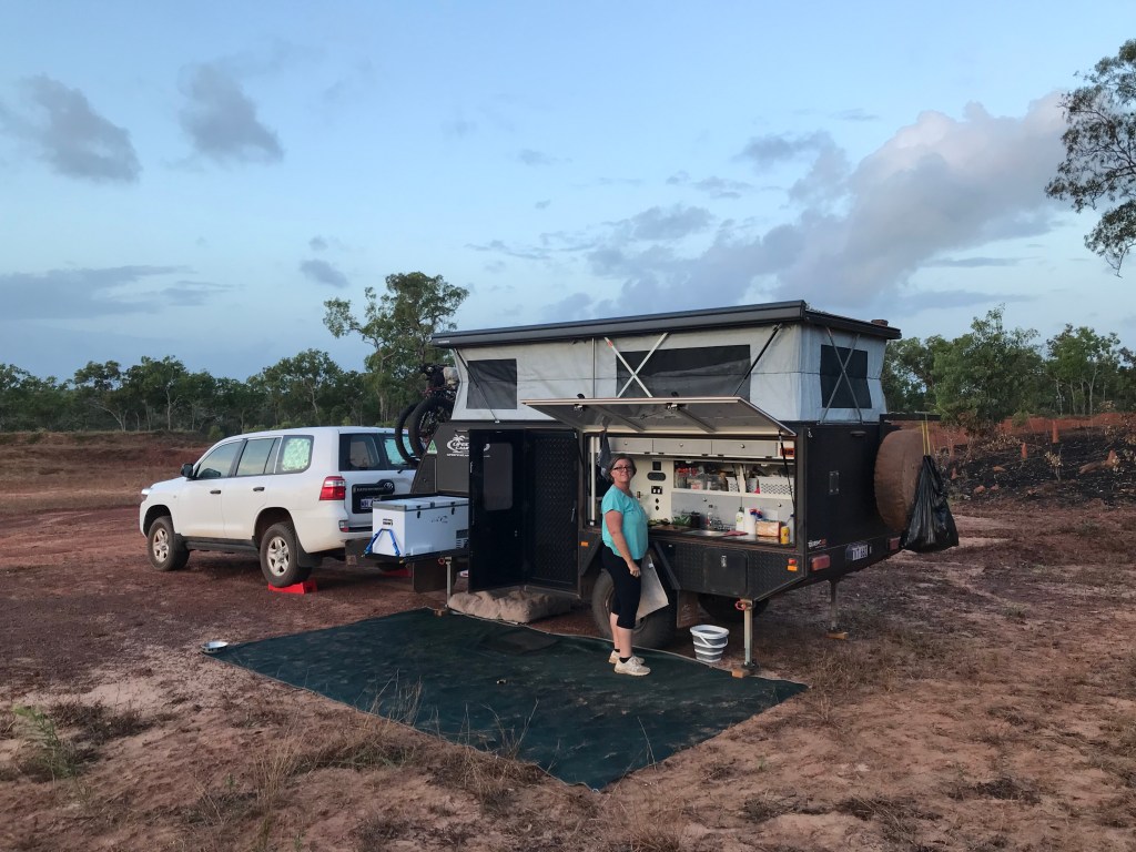
Ok enough bitching, just drive with care and chuck your toilet paper in the bin that is all team wiljen ask (actually dispose of all rubbish like someone who cares). We ended up having a pretty good day with no real disasters. The Redarc battery management system hasn’t managed to recalibrate since disconnecting and rebooting the trailer brake so unsure of how our power is going. May have too redo the whole system again… fit an isolator anyone, Lifestyle Campers are you listening ? I did send them some camper improvement thoughts once but received no response. At least the bones of the camper are solid.
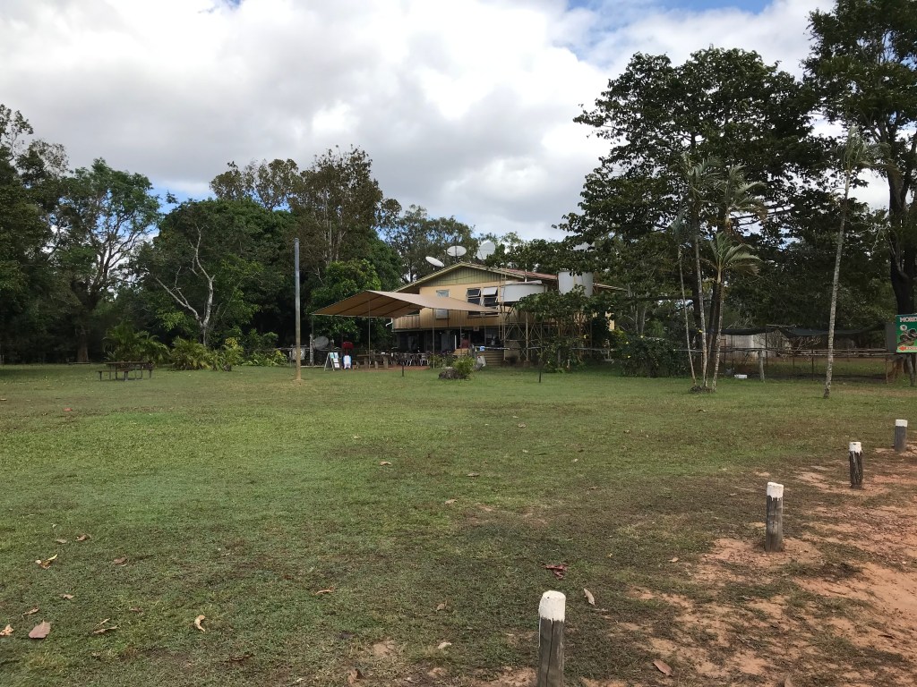
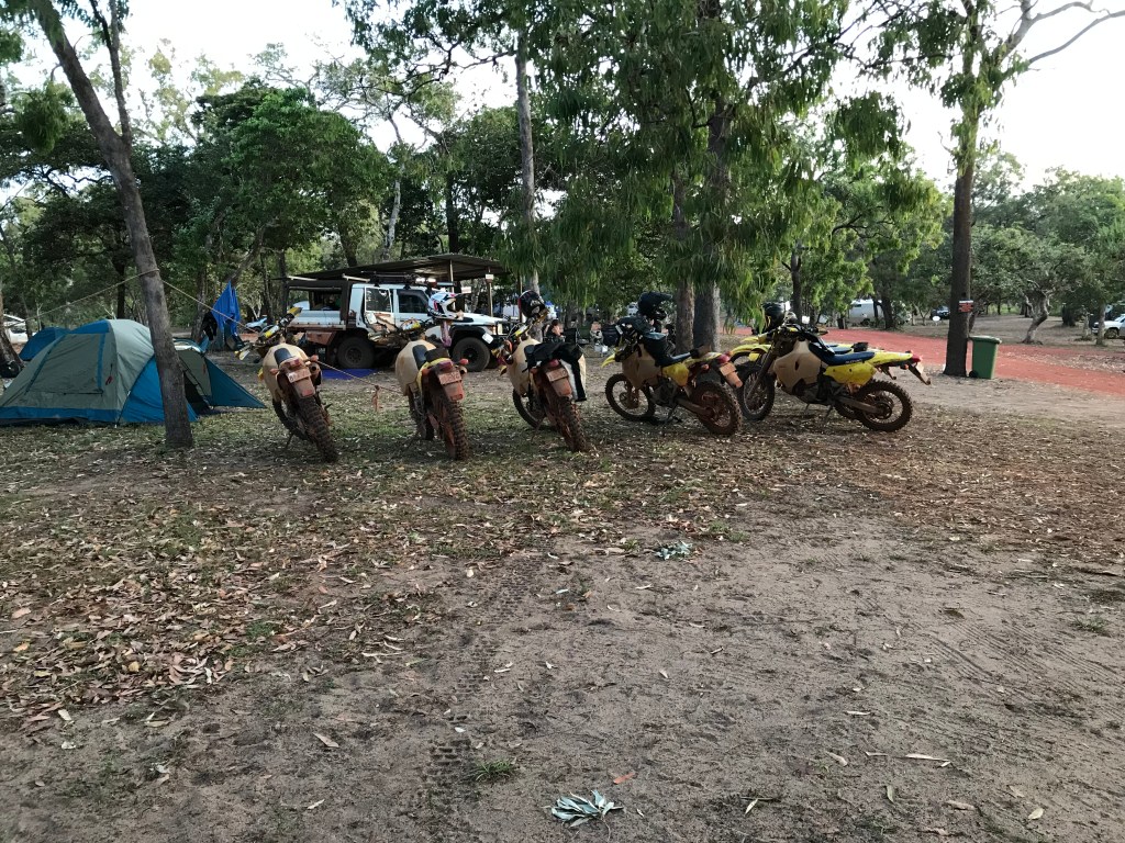
We stopped at Moreton Telegraph Station which is basically a tourist payed camp ground these days. Bought some more food and chatted to overland Cyclist Alex and WA Blue Bus owner Steve. The Blue Bus has busted it’s radiator and Steve is busy trying to resolve his dilemma. Alex who is in his early 60’s is just trying to recover from riding the Overland Telegraph Track (OTT) which he says is very sandy and his bike is running with 2.5″ tyres. He did mention it took all day to do 30kms, lots of walking I would guess.
From there we drove on skipping a fuel stop at Bramwell (still 3/4 of a tank I hope we don’t regret it). As stated earlier lots of imbecile drivers going way to fast or maybe team wiljen are just clueless on how to drive on dirt roads. Though after 35 years of driving experience I doubt that…
25kms of very bad gravel road, think the worst of GGR (Gibb River Road) sections you’ve ever tackled and we’re ready to stop. A gravel pit with a dam brings some respite and end to our day.
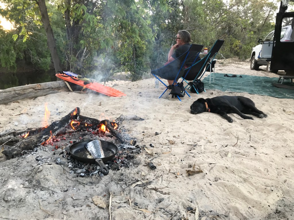
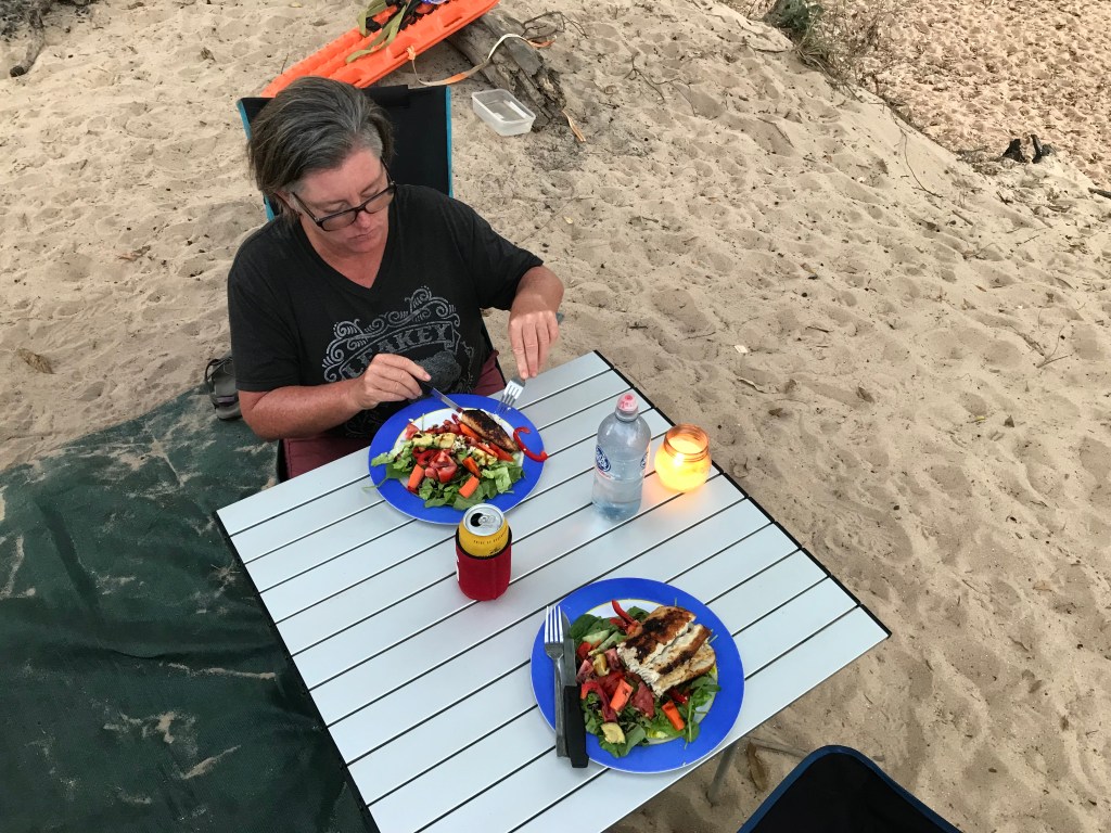
We finish up our day with a camp fire, salad with pork and a hot shower in the open, lovingly this life.


~~~~~~~~
Day 53, Sunday, Date: 1/08/21
From to where: White Dam Gravel Pit to Jardine River
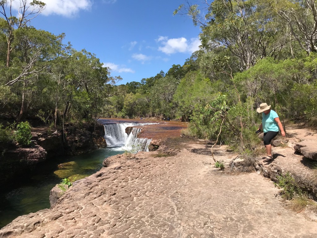
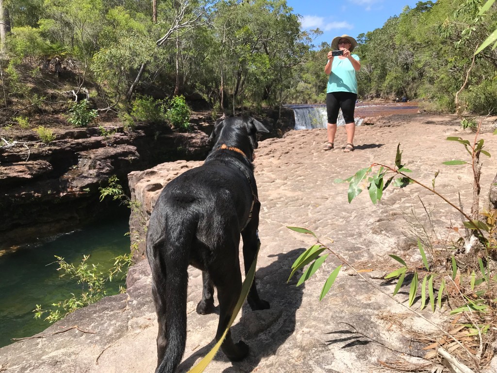
Distance: 156km (18km on OTT into Eliot Falls and Back)
Accumulated Distance: 8574
Cycling Y/N, KMs: no
Fuel $:
Litres:
Accom type & cost: $20 Jardine
Grocery Food $:
Take away food $:
Beer/Wine/Soda $:
Other $:
Day Total $: 20
Rolling Total $: 7620
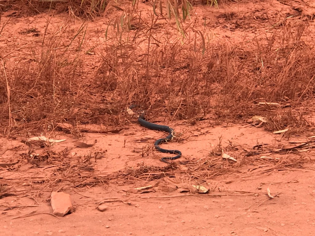
Gopro footage: GP8, huge tiger snake, Eliot Falls
DJI Drone Footage: no
Weather: 30C, cloudy, very strong SE wind.
Notes: Nearly to the Top.
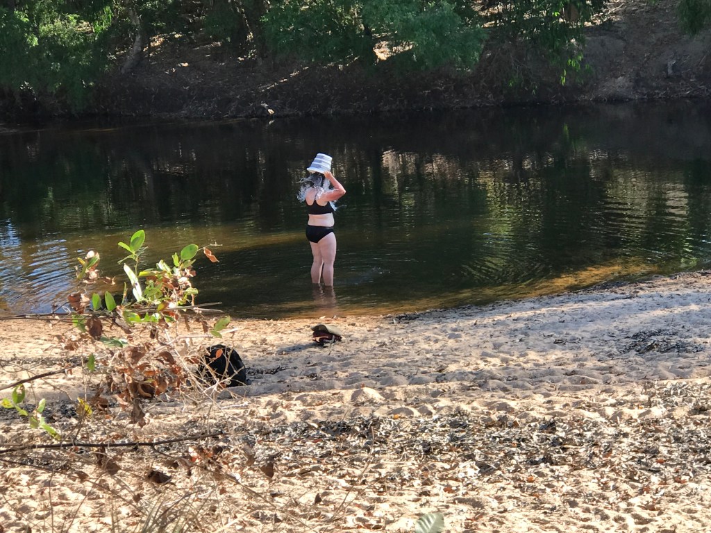
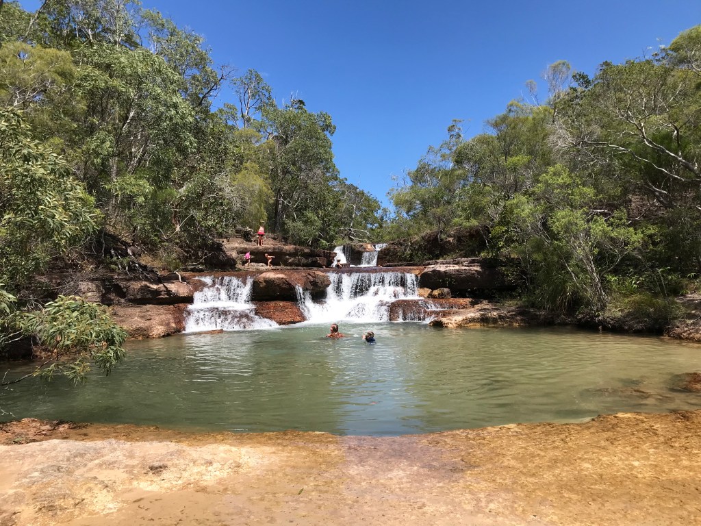
Departed at 9.20am, road rough in places. Drove into Eliot Falls, domestic animals not allowed so we had lunch and a quick look at the Falls with Rodgie on a lead. Very nice and a swim would have been perfect but very busy, one grumpy bloke grizzled about the dog being there. We’ve come to far not to at least have a look.
Back out to the corrugated gravel road to Bamaga, the bush is thick and pretty much jungle we saw a huge tiger snake crossing the road, maybe 2 metres long and thick as my arm. We were hoping for another free camp but as we got closer to Jardine there was road works in progress as the road crews were grading and repairing the road for about 10kms south of Jardine. All the 3 gravel pits were in use so you can’t really park up in a workplace.
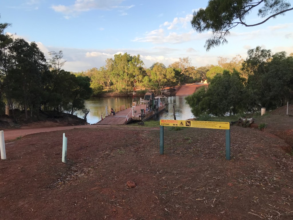
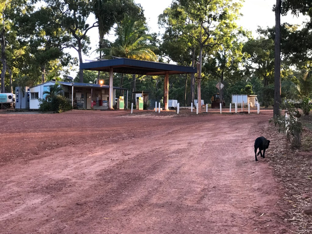
We arrived at Jardine River at 2.30pm, it’s nearly time to park up for the day so we decided to stay the night and catch the ferry in the morning. We met Dave and Deb from Tasmania travelling around in an Iveco Daily off road truck camper. The Jardine Camping area is a disgrace and I wouldn’t recommend staying there unless you are desperate, even at $20p/n. Filthy toilets, overflowing rubbish bins unpotable water and just a general lack of care. The only good point is the staff are friendly. You can’t get fuel here either as the tanks are empty, there is one positive it has good phone reception.
Having issues with the Redarc Battery Management System, it will not register the battery level and is stuck in calculating mode, I removed the whole rear panel section to access it and disconnected everything in the hope it would reboot, but no success. Last option is to repeat the process then plug it into 240v mains power apparently that will sort it out (edit; thar did work once we arrived at Normanton about a week later).
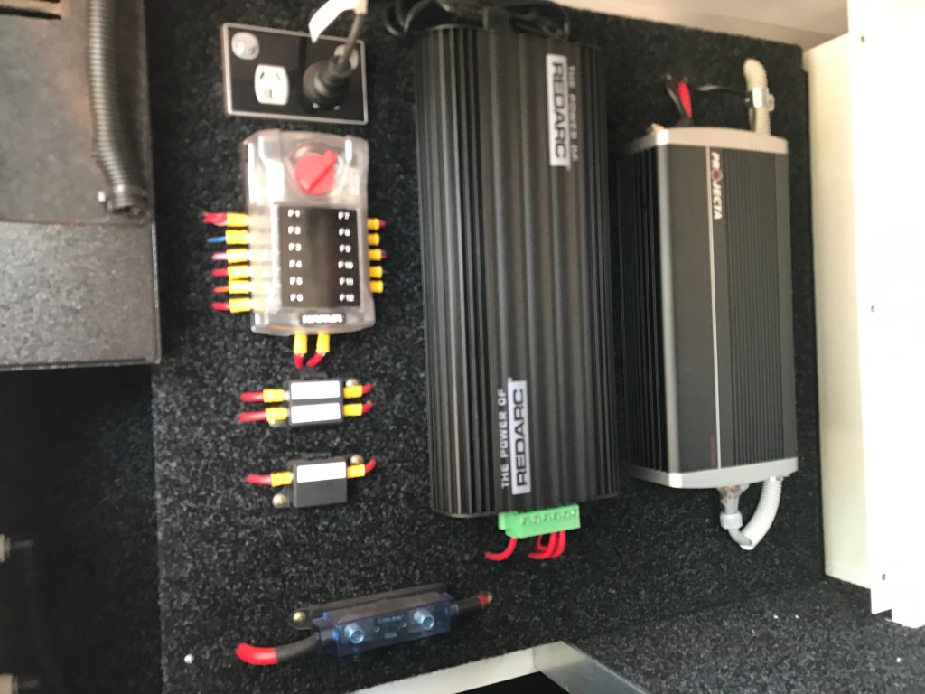
In the mean time I can still monitor the battery volts on the Projector 1000w inverter control panel so all is not lost. There is always something that needs attention out here even with nearly new equipment.
~~~~~~~~
Day 54, Monday, Date: 2/08/21
From to where: Jardine River to Loyalty Beach (Bamaga).
Distance: 36km and a ferry crossing.
Accumulated Distance: 8610km
Cycling Y/N, KMs: no
Fuel $: 138, @ 196cpl
Litres: 70L economy equals 15.5L per 100kms
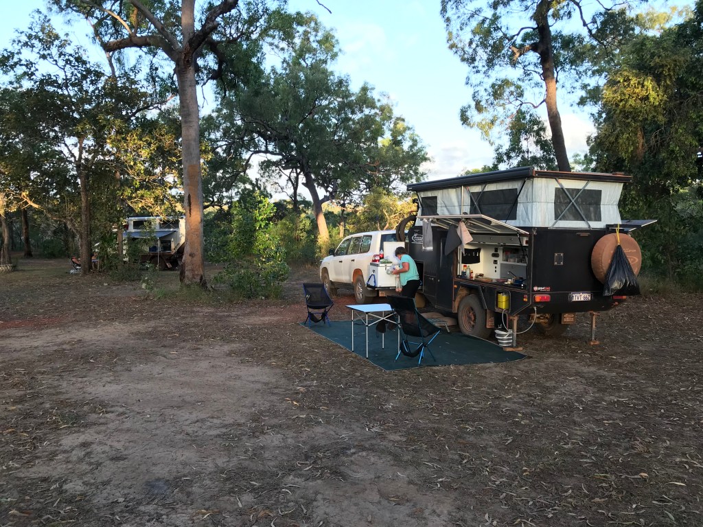
Accom type & cost: $90, 3 nights at Loyalist Beach
Grocery Food $: 91, expensive
Take away food $:
Beer/Wine/Soda $:
Other $: 130, Jardine Ferry Crossing return ticket.
Day Total $: 358
Rolling Total $: 7978
Gopro footage: GP8 ferry crossing.
DJI Drone Footage: no
Weather: 30C strong easterly winds.
Notes: Crossing the mighty Jardine River.

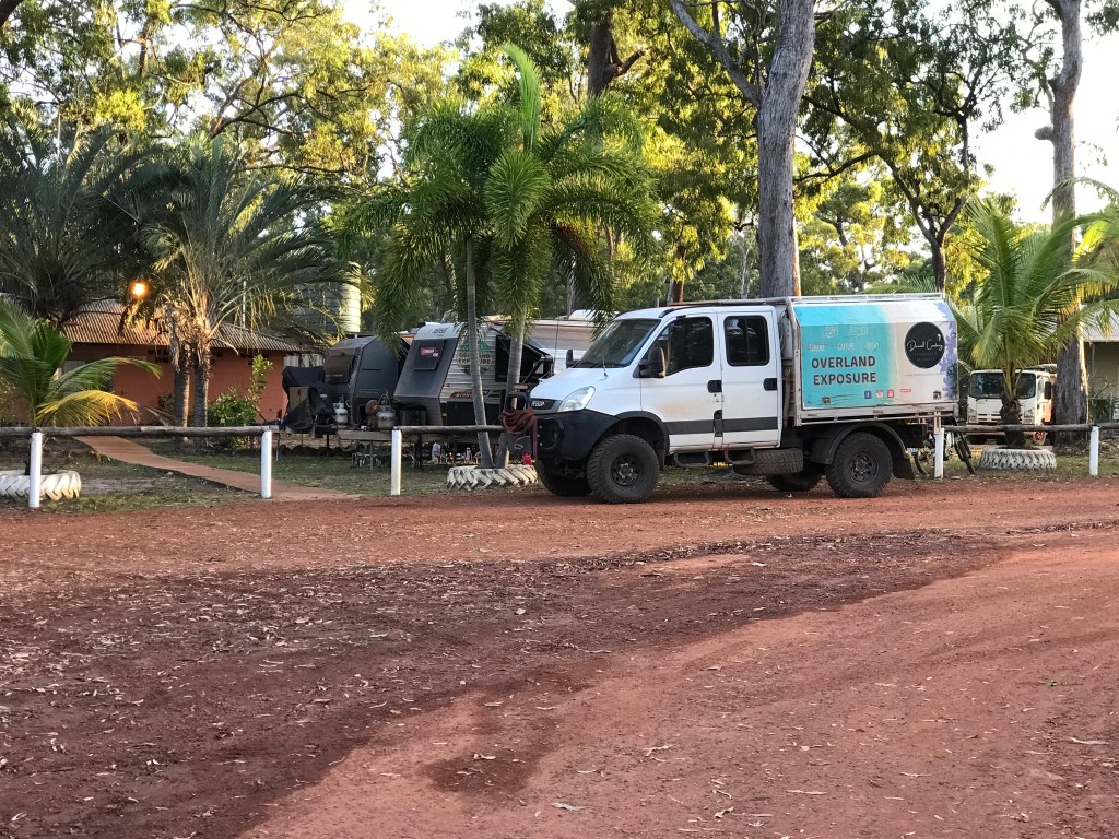
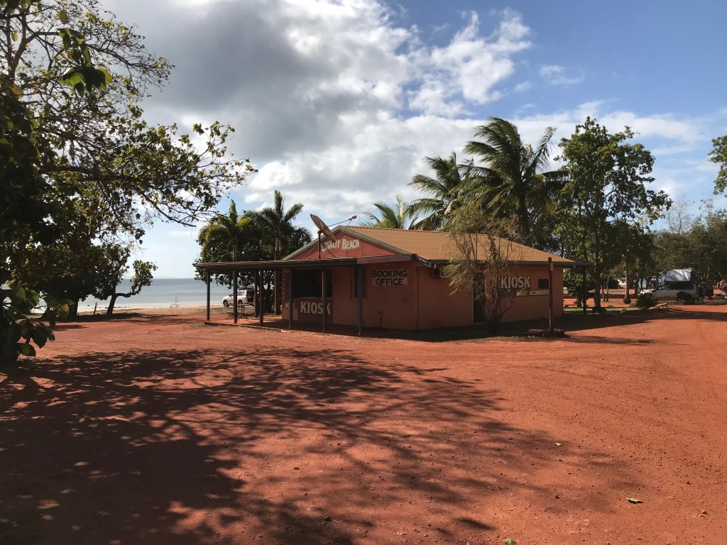
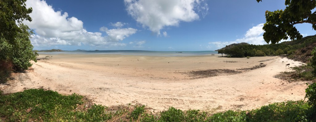
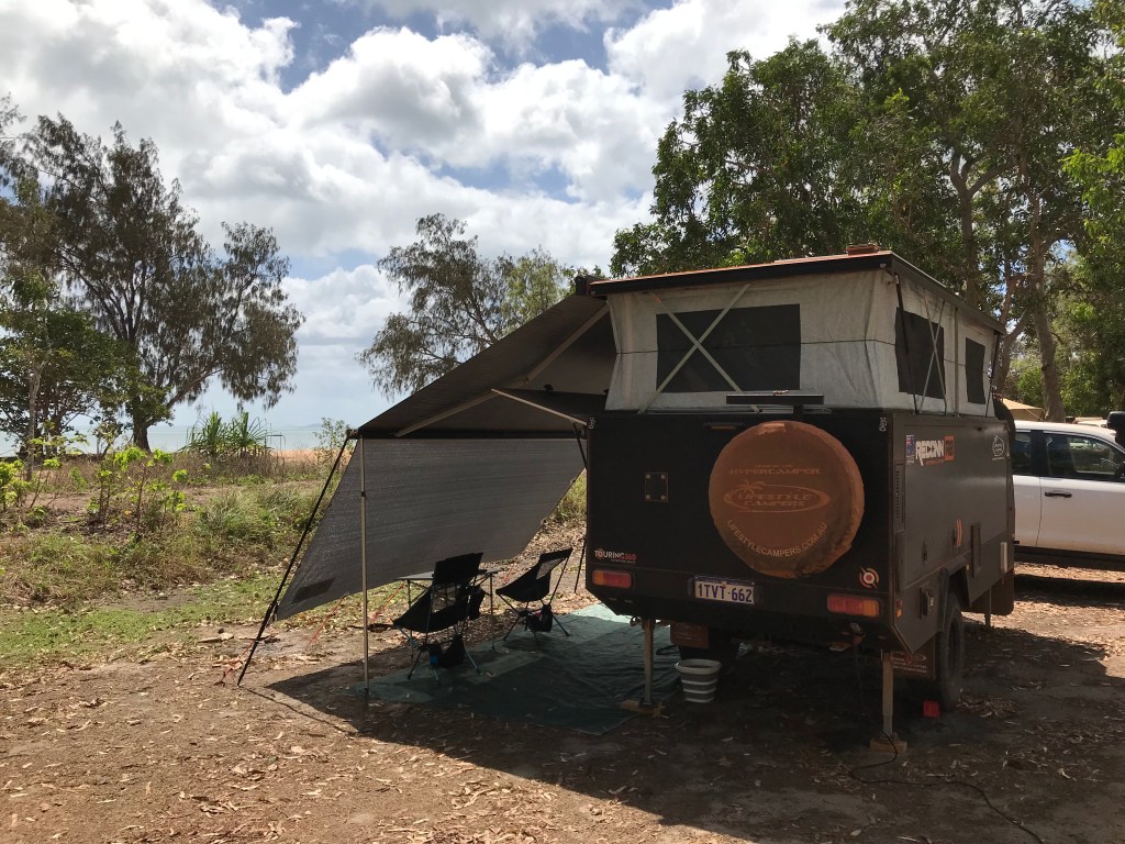
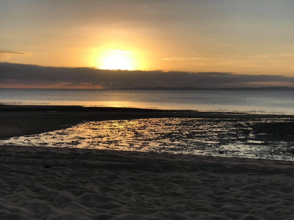
Bit of a nothing day, food shopping, fuel up the car and drive the 6kms out to Loyalty Beach ($30p/n). The camping area is reasonably busy but we manage to find a nice spot near the beach. I borrow a long campground hose to top up our near empty water tank. We just set up for a 3 night stop and check out the beach. Sunset is spectacular as it’s rare to watch the sun set into the ocean on the east side of Australia.
We have been warned by many people to lock up everything and be very careful with our keys. Theft is rife and the police regularly do a patrol through the camp ground. I’m feeling grateful we have Rodgie dog to help watch over things.
~~~~~~~~
Day 55, Tuesday, Date: 3/08/21
From to where: Loyalty Beach to Pajinka to Bamaga to Seisia & back.
Distance: 85kms
Accumulated Distance: 8695km
Cycling Y/N, KMs: no
Fuel $:
Litres:
Accom type & cost: payed
Grocery Food $:
Take away food $:
Beer/Wine/Soda $: 90, Block of beer, $45, 6pack of premix spirits.
Other $:
Day Total $: 135
Rolling Total $: 8113
Gopro footage: GP8, Yes of the Tip
DJI Drone Footage:
Weather: 33C, 35km/h SE winds, some build up type clouds, mostly sunny.
Notes: The Official Halfway Point, of this tour. Cape York !
Lock up your daughters, lock up your sons, lock up your dogs, sticky fingers is an issue up here. Lots of people have warned us about theft, one of my many light hearted nicknames is “Security Will”, I’m paranoid about people stealing our stuff. It has happened to us too many times in the past. Before we went to sleep last night I stashed and locked everything.
At 12 midnight Rodgie (who still sleeps on the floor with us inside the camper) goes nuts ! I turn on an outside light and say “what the fuck is going on out there, get ready for the dog who ever you are”. Of course I wouldn’t send Rodgie out there but hey they don’t know that she’s a sook but she does have a loud bark and a low guttural growl. Some drunk male voice replies “it’s ok I’m just going to the shower” most likely true but why are you walking right next to out campsite at 12 midnight mate?
We awaken to another hot humid day, max temperature is predicted to be 33C. After breakfast it’s time to get ready for the “big event”, we dress in appropriate clothes and plaster ourselves with sunscreen. Reluctantly we cast off our sandals and put on our walking shoes. To the credit of all the YouTube creators we have watched who have blogged about the Tip they don’t really let you know exactly what you are in for.
As we leave Loyalty Beach we turn left down a track that is suppose to be a short cut to the main dirt road to Pajinka, this track turns into a minor adventure all of it’s own. It’s not really a 4WD track but we did err on the side of caution and engage low range 4WD for one largish creek crossing. that was up to the bottom of the car doors. The drive out to Pajinka is about 30kms, the majority of it through thick tropical Jungle.
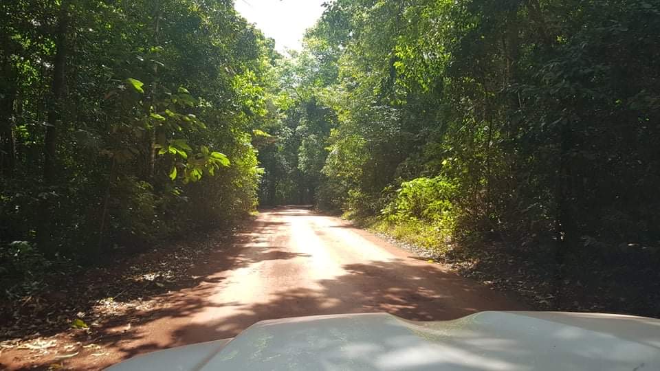
You can only travel at about 40km/h because it is very windy, single lane and visibility for oncoming vehicles is poor. This didn’t stop the speed demons wanting to pass me, I’d let them by when it was safe to pull off. The drive was beautiful, we wound the windows down and enjoyed the smells and sounds of the jungle .
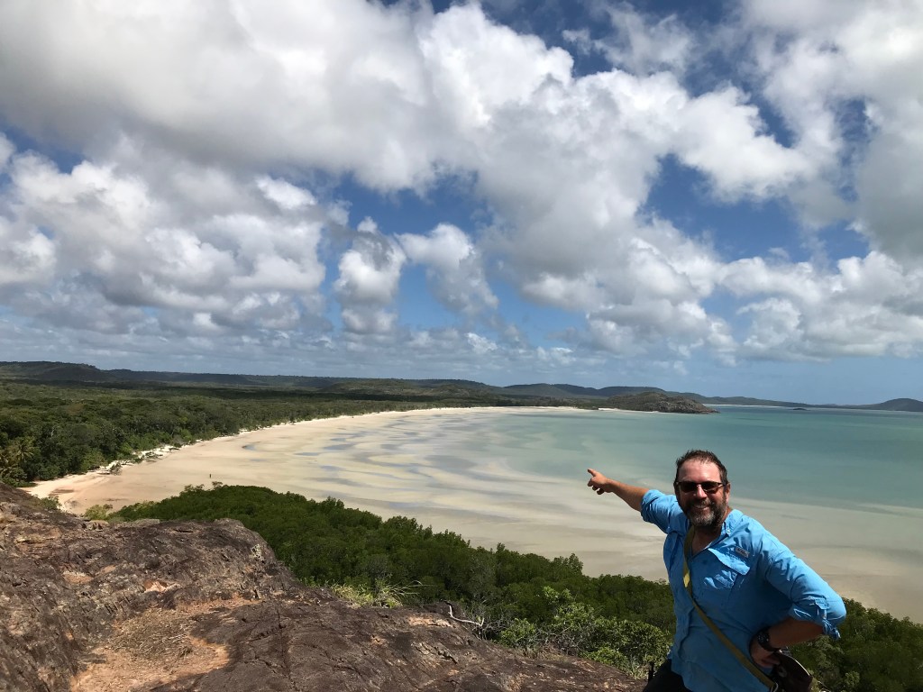
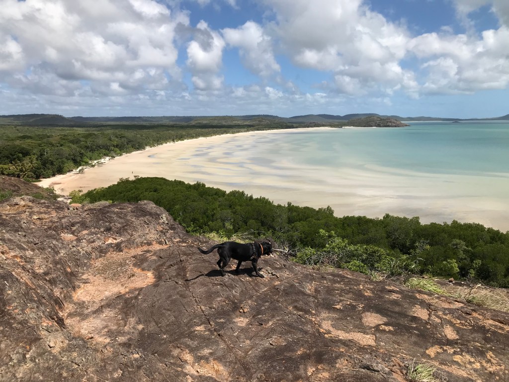
Once at the parking area we struggled to find a spot to park, then got ready for the walk. The tide was out so we cut halfway along the beach, it’s only a 10 minute walk to the Tip of Australia for an average fit person in their 50’s, but we did have to wait for a bunch off a tour bus to squeeze by us, some of them were invalids and needed assistance. Rodgie was enjoying herself immensely.
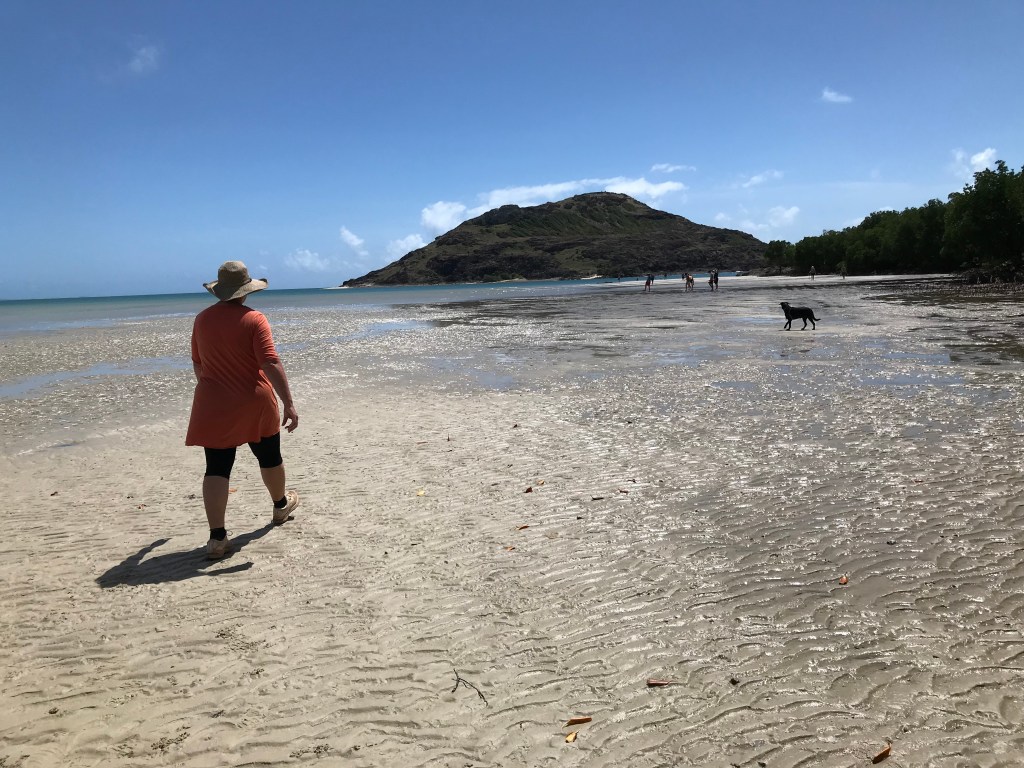
Once we were at the Tip we were lucky because the earlier crowd had begun to dissipate. We took in the view, finding it hard to believe we had finally made it to the top of Cape York Peninsula, mainland Australia’s most northern point. I thought we would have come here years earlier but better now than never.
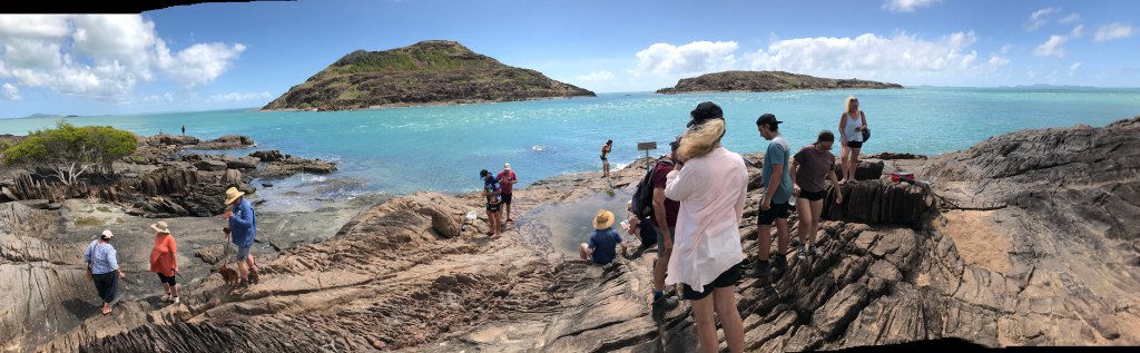
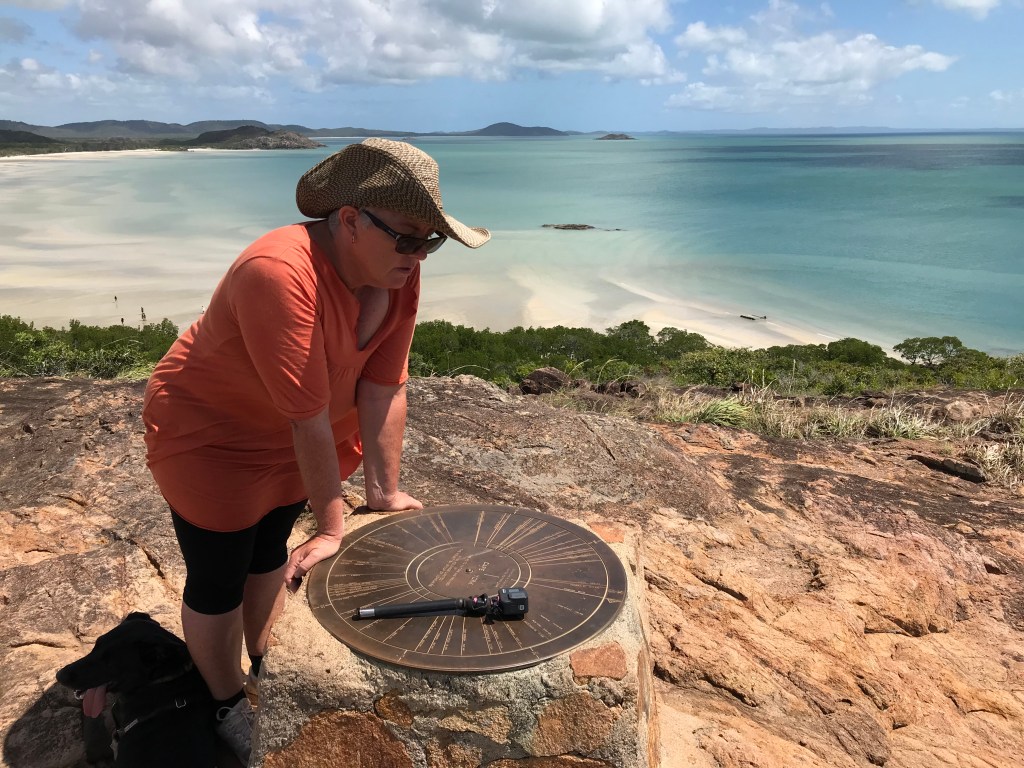
Jenny and I took our photos and video hung around for about 15 minutes then instead of following everyone else taking the easy route back to the car park we decided to climb the peak. There are a few stone cairns around but at the very top of the peak is a brass plaque that shows distances to other locations. I notice Papua New Guinea is only 190kms north of us, Bamaga Tavern is only 37kms, Perth WA is 3420kms in a straight line.
We decide that the Bamaga Tavern is the closest so head there, at the Tavern there are alcohol restrictions which really is just an other version of segregation for the local population to put up with. You can only purchase one item of alcoholic drink, ie. 1 block of beer or 1 x 6 pack of premixed spirits or 1 x 2L cask of wine. No you can’t buy a block of beer and a six pack of UDL’s at the same time, that is not allowed. I won’t incriminate myself on how we got around the problem but I’m sure you can figure it out.
Back at Loyalty Beach, Jenny and I enjoy sunset drinks. I’ve got a beer and Jen’s got a can of Captain Morgan Spice Rum and Cola. We sit on the beach and watch the sun sink into the west it sets quickly into the ocean. Watching a sunset into the ocean reminds us both of home. We are officially at the halfway point of this journey, it’s time to make the long drive home.
~~~~~~~~
Day 56 Wednesday, Date: 4/08/21
From to where: Loyalty Beach, 6kms east of Bamaga.
Distance: 0
Accumulated Distance: 8659kms
Cycling Y/N, KMs: nope
Fuel $:
Litres:
Accom type & cost: payed
Grocery Food $:
Take away food $:
Beer/Wine/Soda $:
Other $: 10, washing 2 loads
Day Total $: 10
Rolling Total $: 8123
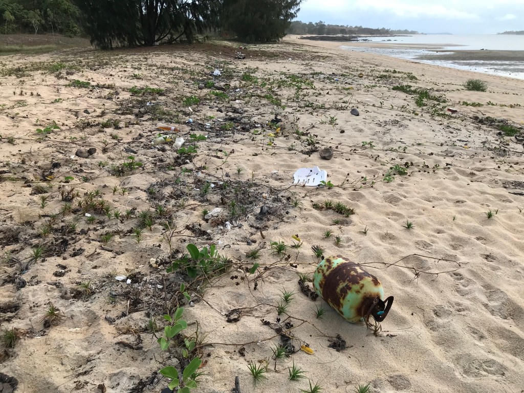
Gopro footage: no but some video of beach drift rubbish on iPhone7.
DJI Drone Footage: no
Weather: intermittent rain, 30C very cloudy, light east wind.
Notes: Halfway Day, start of week 9, washing, maintenance, prepare for the long journey home.
Pretty much a nothing day, caught up on the washing, tried to blog but reception is to poor, performed preventative maintenance like cleaning filters, greasing trailer suspension, etc. Jenny tried to work but same as me, inadequate phone reception. Very backwards when it comes to connectivity out here in FNQ, keep in mind we’re only 6kms from the town of Bamaga.
Walked the dog along the beach a couple of times, guess we’re ready to head for home. It did rain on and off which caused a few problems drying our washing. Lots of drift rubbish along the beach which is sad but a fact of life in our our disposable society of the 21st century.
Since we left Port Douglas I haven’t been feeling that great, seem to have excessive fatigue, aching muscles in my arms and legs, lethargic and a few other strange symptoms like blocked ear. Hoping I get over this feeling soon, starting to suspect a case of Ross River Virus or similar, who knows ? If it doesn’t improve I guess I’ll have a blood test to find out, have checked all over my body for ticks and am all clear.
~~~~~~~~
26/08/21, Hi everyone, future Team wiljen here. Right now we’re somewhere in the Northern Territory. Best I don’t reveal to much about locations at this point as we are going to be trying to cross the Western Australian “Hard Border” soon and now is the time for keeping our cards close to our chest. The Covid Genie is out of the bottle and Australia is suffering a severe infection of virus paranoia.
Right now all of NSW and Vic are in full strict lockdowns, there are curfews, 5km travel limits, freedom protesters are being shot at with rubber bullets & tear gas, it really is getting out of control. It’s a version of marshal law like Australia has never experienced before in modern history.
It’s pretty obvious that we should get home sooner rather than later as what happens next is anyone’s guess. We have observed a lot of things during our journey and talked to a lot of people. Australia is now a totally different place to what we were once familiar with. We see the situation rapidly deteriorating over the next 6 to 12 months as vaccinations become made mandatory, vaccination travel permits/passports become compulsory, inflation increases, China begins to tighten its screws on Aus and the everything bubbles begin to pop. Extended travel is going to be put on the back burner while we get ready for the tough times ahead. I hope we are wrong and just overreacting ?
Thanks for reading, I’ll endeavour to complete this whole Australia Pandemic Tour travel blog through to its conclusion and once home post some YouTube videos of it. Back soon, Will, Jenny and Rodgie dog.

Love your blogs WilJen, enjoy the rest of your adventure.
Julie & Al
LikeLike
Thanks Julie and Al, we’ll be home soon for a post tour debrief with you.
Will and Jenny.
LikeLike